Dales images 2015, fracking hell, litter louts, curlews calling

dales images viaduct
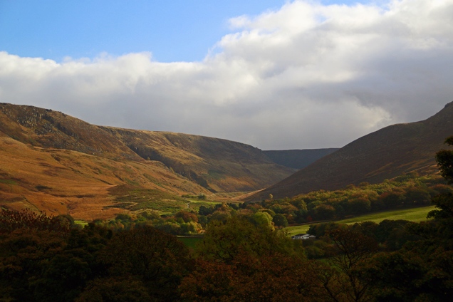
I wrapped up warm and headed for the the head of Ribblesdale on Sunday to see what the snow was like and hopefully capture some more Dales images. Obviously, the top photo was not taken last weekend, but I just couldn’t bide having yet another grey-sky shot to kick off the blog. To greet me at the gate of Ingleborough National Nature Reserve was a large brown bag from McDonalds left by some inconsiderate half-wit. It included containers of partly-eaten food. The nearest outlet is more than 30 miles away from Ribblehead, and I wondered just how many bins the moron passed on his/her way to the beauty spot. I put the rubbish in my car boot, took it home and binned it – not too difficult a task – but I certainly wasn’t ‘loving it’. Ice and a cold wind didn’t lighten my mood but at least I didn’t encounter any rain – for at least an hour or so.

dales images icyquarry

A few outdoor types also leave evidence of their presence in the Dales. I read this week on www.grough.co.uk that a group put together by Kuta Outdoors bagged 16 sacks of rubbish on a clean-up around the Yorkshire Three Peaks route. Kuta Outdoors, who take groups along the Three Peaks routes several times a year, organised the litter pick with people who had walked alongside the company in the past raising money for various charities. Company owner Phil Lee said: “If everyone who comes to the Three Peaks picked up a bit of litter when they saw it, the peaks would stay clean all season.” Well done Phil and the litter-pickers but you really shouldn’t have to do this.

Curlew calling for help

The call of the curlew comforts me. It’s one of the signposts that reminds me I’m tramping the Yorkshire moors. I listen and watch out for the bird from April as it nests around here, and I’ve been known to follow the Ribble to dales images curlewMorecambe, where it spends the winter, to watch it paddling about in the bay. Sadly, the curlew is now on the RSPB’s ‘Red List’ of endangered species www.rspb.org.uk  They say the problem is caused by changes in upland management and increased predation. Nature is so finely balanced. Too often we forget we’re not the only species on Earth. I snatched this photo of a curlew as it carried out a fly-past over my head while I was walking between Helwith Bridge and Silverdale earlier this year.

images ribbscar

Trees please

I won’t be sending Christmas cards this year. Instead I’ll be making a small donation to the Woodland Trust. Sorry if that sounds like I’ve a bit of a ‘holier than thou’ attitude. I also think that dedicating a tree to someone is better than giving them a box of Quality Street – bet you’re glad you’re not on my Christmas list. The Woodland Trust does a great job campaigning against indiscriminate felling of trees and saving ancient woodland. Above, trees on Stainforth Scar; below, Gisburn Forest.

dales images gisburn

Wow! Amazing!

I’ve been a fan of Nature and outdoors programmes on TV for many years but I must admit to tiring of them now. Constant dumbing down; the way they give us a five-minute chunk of a story then ‘come back to it later’ really frustrates me. ‘Experts’ are given the shortest time possible to explain things properly so that OTT presenters can ‘have a go’ – I really don’t give a damn if ‘Ellie can milk a llama’ or not. And I’m constantly asking myself what these TV presenters said before they discovered ‘wow’ and ‘amazing’? Must be an age thing.

Fracking hell

Remember the way the Tories heralded their ‘localism’ idea of a few years back? Locals will get to decide on local matters and we’ll all live happily ever after, they claimed. And do you recall how they promised our National Parks and green spaces would remain free from developers and be kept for us all to enjoy? Guess what – they were lying. I’ve watched industrial wind farms spring up all around the Dales and on the edge of the National Park like some giant fence – most being erected against the wishes of the locals. I’ve seen bits of green land gobbled up by developers, again against the wishes of the locals. And now they are allowing more capitalist friends of the government to frack up our countryside. There are parts of the USA and Australia where fracking has taken place on a massive scale; where the consequences have included the contamination of water supplies, toxic waste destroying fertile ground, plants, trees and animal habitats, and huge disruption to the lives of residents. For a map of possible UK fracking sites click here http://frack-off.org.uk/locations/

Dales images 0f 2015

On re-reading this week’s blog, it seems like the persistent damp, grey conditions here in the dale are definitely making me grumpy. At least the bad weather has given me chance to motor on with an idea to portray a year in North Ribblesdale using my snaps. I’m going to be pasting on the site a photo (or two) from every week during 2015, starting this month with Dales images taken between January and April. I’ve not necessarily chosen the best technical or artistic shots, just the ones that tell a story or portray the dale at the time. Hope you enjoy them – May, June, July and August to follow next week (unless we have cracking weather and I’m out and about instead of staring at a computer screen getting even more miserable and political). You can click on the Dales images on the carousel to enlarge (automatically scrolls every 3 seconds). Merry bloody Christmas.

Floods, pixies, rainbows and poor development


floods top

I was annoyed that I couldn’t get to Malham to capture the rare sight of water tumbling over the Cove last weekend. The road from home to Malham was blocked, and with floods all around Settle I didn’t want to risk a longer journey. Settle bypass was also closed and the alternative route through town and up Buckhaw Brow was under water in parts. I did walk up to Giggleswick Scar and snapped the water lying in the Ribble valley floodplain. The former Giggleswick Tarn (top pic) also made a rare appearance. In 1863 a chap called Joseph Taylor came across a medieval dug-out canoe while carrying out drainage works on the site of the former Giggleswick Tarn — just thought I’d tell you.

floods lake ribble

floods waterfallAlso making a comeback was a stretch of water beneath Stainforth Scar near Langcliffe, and a waterfall down the scar — not quite as spectacular as the one at Malham Cove but a rarity all the same.

floods new tarn

While I was scuttling about around the old tip beneath Stainforth Scar, trying to find a decent spot to take the waterfall photo, I spotted this tiny fungus growing on the tip of a fence post. Nature never ceases to amaze me. I swear I noticed a couple of tiny dancing pixies but I put that down to the previous night’s red wine.

floods pixies

You will have noticed that I’m slightly better at photographing things that stay still for long periods. For three days this week I visited the millpond at Langcliffe Locks trying to capture a spectacular kingfisher which I first glimpsed on Tuesday. There was another flash of blue, inches above the water, on Thursday but I was too slow to get a picture. Friday I loitered around again but didn’t see it. I was distracted briefly by a squirrel scampering across a wall but once more I was too slow focusing on the speedy little beggar. Later it popped up on fence just after I put the camera away. It was definitely smirking.
floods bridge

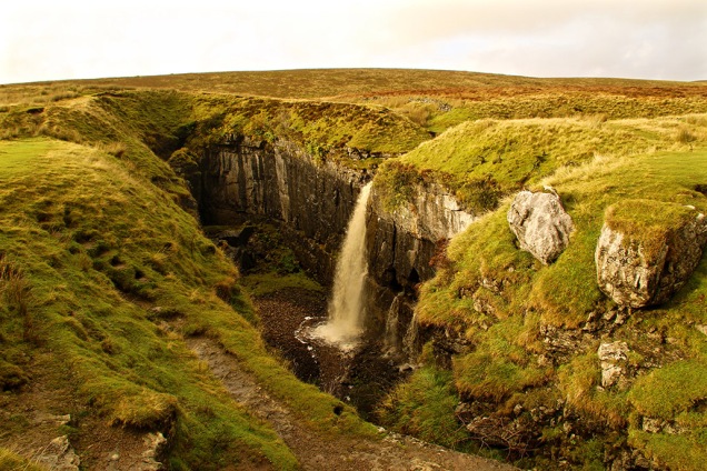
While in Stainforth I nipped down to the Foss which was in an excited mood; a thunderous, boiling cauldron in fact, as the Ribble swept through like a tidal wave first beneath the ancient arches of the packhorse bridge and then over the deep, rocky precipice.

floods boss

The river was much calmer on Friday after its exertions of the previous few days. I often wonder why the Ribble rushes so much in these parts — you’d think it would saunter through Yorkshire and push on as quickly as possible through Lancashire.

floods calm

Yesterday we were hit by snow and yet more rain. You’ll be starting to think this blog is just about the weather, but it really has dominated life recently in the dale and beyond. At least some rainbows around Ribblesdale helped briefly brighten the place up. The Christmas lights in Settle are also cheering — let’s hope the weather doesn’t totally ruin the year’s best week for local traders.

floods rainbow

Floods

Like most people — at least those living north of the M62 — my thoughts have been with those affected by the storm and floods in the North West. Sometimes there’s not a lot we can do about taming Nature and we just have to cope with it — as the good folk of Cumbria seem to be doing: help if you can… http://www.cumbriafoundation.org

Understanding flood plains and leaving them well alone is, however, something people CAN control. Yet a recent report by Greenpeace states that almost half of those areas fast-tracked for new housing development by the government are on floodplains. On top of this, the number of staff in the floods and coastal erosion risk management section of the Environment Agency has been reduced dramatically in the past three years, along with the agency’s funding. Trying to solve one problem by creating another is very poor management of the country’s affairs.

Feedback

It seems that I am one of the few people in the world without a smart phone. I’m really old fashioned and still use a computer (one of those things that sit on a desk with a big screen – you remember them, don’t you?). It appears that the flipbook of Ingleton I produced for last week’s blog doesn’t work too well for those who prefer squinting at a tiny screen and swishing it around in circles to avoid reflections. So I’ve produced a more ‘mobile-friendly’ version here…

For anyone who has more money than sense and owns one of those watch-screen-thingies then… tough, get out more and go see Ingleton for yourself (smiley do-da wotsit here).

A wet week, but who cares – London’s okay

ribbleheadTrain tannoy: “Ladies and gentlemen… as we cross the famous Ribblehead Viaduct, on your left you will see absolutely nothing; on your right, there is a very wet bloke with a camera.” Walking round Ribblehead when the rain is traveling sideways, you quickly learn which items of your gear warrant an all-weather tag. I hope Santa is well prepared, because there’s going to be a lengthy ‘I want’ list from me. My ‘fully waterproof’ bag ended up with a puddle in it – at least I can confirm the bottom doesn’t leak. (By Friday many trains along the Settle-Carlisle route were cancelled due to flooding. At one point in the Eden Valley the river was over a mile wide.)

clapbridge

A brief respite from the rain on Friday tempted me out to do a little long-exposure photography – not everyone’s cup of tea, I know, but a useful skill to learn properly. There was probably a bit too much water, flowing too quickly, down Clapham Falls to get a satisfactory ‘silky’ effect. But while in the village I couldn’t stop myself taking the stock photo across old Brokken Bridge. This scene always makes a good in autumn or winter photo.

shroud

This tiny waterfall in the former quarry at Ribblehead appears quite angelic and there’s even a shrouded figure merging. I did the short ‘green’ walk around the Ingleborough National Nature Reserve (which includes the quarry). Although the tops of Ingleborough and Whernside were shrouded in cloud, Penyghent could still be seen beyond Gauber and Colt Park.

pyggauber

I was so bored during the poor weather this week that I actually started to sort out a cupboard where books and other bits had been tossed when I first moved into the house. I soon stopped though when I came across a 1920s guide book to Ingleton. It’s a fascinating window into life ninety years ago. In those days tourists flocked to this part of the world mainly by rail and charabanc – but increasingly by road, as reflected by the adverts and editorial. There were once two railway stations  serving the village – one, run by Midland Railway company, was where the village community centre now is in the car park, and the other was at the Thornton side about a mile away, operated by London & North Western. At one time, to change trains from one operator to the other, passengers could pay a penny fare to cross the viaduct between the two stations and enjoy the view.
You can view the whole leaflet by clicking on the link below. (Press esc to return to this page if viewing on computer.)

If you’re on a mobile click here to view the Ingleton Guide

NB I have tried to check copyright details on this publication. The publishers, Ingleton Advertisers Association, no longer exist. If anyone knows of a copyright holder please let me know and I will gladly acknowledge them.

langflood

Yesterday afternoon I took an exhilarating short walk with Desmond (the storm, not a new friend) around Langcliffe. I thought, once you’re wet it doesn’t really matter does it? The route of my regular jaunt by the Ribble is usually alongside the river bank… there appeared to be this small puddle in the way so I gave it a miss.

Having my regular walk disrupted is, of course, a minor inconvenience compared with the problems being caused by Storm Desmond. Some of the flooding in the region and further north is catastrophic for many people and will affect their lives for many months, if not years. The government is willing to spend millions every night on bombing Iraq and Syria in the belief this will protect us against terrorists, but it has actually held back money for properly protecting some towns and villages in the North West from flooding. But then again, it wasn’t London under attack from Mother Nature was it, just those uncouth tribes of the North.

wifehole

Feedback

Talking of uncouth, I’d like to say to an old friend that his suggestion for the origin of the name Braithwaite Wife Hole, is totally wrong and uncalled-for. My thanks to those others who tried to decently explain the sinkhole’s name mentioned in last week’s blog. In what must be one of the longest book titles going (‘A descriptive tour and guide to the lakes, caves, mountains and other natural curiosities in Cumberland, Westmorland, Lancashire and a part of the West Riding of Yorkshire’) John Housman, writing in 1800, calls it Barefoot-wives’ Hole. This name is also found in West’s Guide to the Lakes, 1778/1821 and on old maps dating as far back as 1760. A map of 1890, however, shows the name has been changed to Braithwaite Wife Shake Hole. Just like with many place-names and surnames, early scribes often misunderstood local terms and accents when it came to writing down terms that had previously been passed down through generations of verbal history, so perhaps the original name will remain a mystery – unless you know differently.

Signs of the past, dodgy wives and the Elf King

sunsetpyg

After last week’s regular Sunday stroll by the Ribble under Stainforth Scar I stayed out a bit later than normal to watch the sun go down. Golden light settled briefly on the Scar, while Penyghent looked cooler in the distance with snow still lying in the shade. The late sun shining through the trees above Langcliffe stopped me in my tracks. No filters or Photoshop shenanigans on these shots, just the ‘sunset’ setting on my camera.
treegatesun

pjsignpostAround 40 years ago I posed for this photo at Ribblehead (taken by my friend Graham Hobson). The signpost was replaced with a bland version many years ago – probably due to idiots climbing up the old one. The photo serves to remind me just how long I’ve been visiting this enigmatic area. I’m always finding something different or interesting here – long may it continue. I was there again on Wednesday, taking a boggy trek around the Limestone Walk on Ingleborough Nature Reserve in Chapel-le-Dale. There were still some icy patches along the path where the sun hadn’t reached, and flecks of snow were still visible on Whernside.

ingleuprightAlong this route you can hear water rushing into and through the limestone caverns beneath your feet. There’s a great network of caves and pot holes around here, and the path, going clockwise, passes Great Douk Cave then later, joining the main path up to Ingleborough, goes by the amazing sinkhole of Braithwaite Wife Hole – partly pictured below. It’s around 80ft deep and knocking on 200ft wide. I’d be interested to know how it got the name – there are a few sink holes named after wives in the Dales. Legend has it that the ladies were chucked down the giant pits after some misdemeanour. But if that were the case you’d think there’d be even more of them named after men.


wifehole

oldfarmIt’s sad to see old farm buildings in a dilapidated state – like this one at Southerscales in Chapel-le-Dale. But I suppose it is all part of the evolution of the Dales. Less than a mile away on one of the limestone ridges between Ingleborough and Ribblehead are the remains of an ancient settlement, dating back thousands of years. In this part of the Dales humans have come and gone since prehistoric times and evidence of ancient walls can be found all around…
oldwall

Making a living on this boggy land has always been extremely difficult. Shaded by Ingleborough, Simon Fell and Park Fell, there is little direct sunlight during winter. Hardy farmers still try to eke out a living here…

farmer

I took some fine photos of Chapel-le-Dale along the route, which I’ve already posted on Facebook and Twitter this week, showing Twisleton Scar, Whernside and Ribblehead Viaduct. Here’s a different one, looking down on the small settlement around the Chapel Inn.

chapdale

As Black Friday turned into Grey Saturday there were few photographic bargains to be had in the dales for me, but one of my neighbours, Mark Corner, emailed me this photo taken on Giggleswick Scar. Myths and legends surround these ‘fairy circles’, and here Mark’s lovely dog Oscar looks like a worthy king of the elves.

corner

Water way to go, cats, dogs and a dodgy chopper

ribweir

The value of natural flood plains in the Dales was highlighted this week as they calmed the flow of rivers swollen by the excessive rain. New lakes were created here in Ribblesdale and throughout the region, saving communities further down the valleys from severe flooding (apart from where housing and industrial development has been erroneously allowed). As well as poor planning decisions there are other problems along riverbanks which have been created by humans. One is the way some landowners have banked up river edges to preserve or increase grazing land. In times of flood these act as barriers, and instead of letting rivers spread naturally, they speed up flow causing problems elsewhere. Weirs, built in many cases to help power old mills and create mill ponds, can also have an adverse effect. I watched the weirs and Langcliffe and Settle this week and saw first hand what they do when the rivers are high and fast-flowing. These artificial barriers raise water levels behind then cause a huge hydraulic jump afterwards. This causes great turbulence and danger in the worst conditions as witnessed in my picture. I’m all for capturing a river’s power to create electricity through well-placed turbines but I wonder if weirs are really necessary today? Also, in low water weirs are a barrier to fish migration and promote the growth of algae.
dogturd

There’s a popular walk from Settle along Watery Lane, but it proved a bit too watery last Sunday. I did manage this photo, however, where it seems the local allotment holders or perhaps fellow walkers are fed up with coming across doggie-do. I’m not sure whether the luminous paint looks worse than the dog mess but it certainly gets the message across.
inglequarry

There was still plenty of water at the top of the dale on Monday as I took a stroll in the Ribblehead region and around Ingleborough Nature Reserve. Signs of industry don’t have to be depressing and can create some interesting views.

kilningle

whernquarry

While I was below  Ingleborough I came across the Coastguard Sikorsky S-92 helicopter which had got into difficulties the previous day. The Cave Rescue Organisation, based in Clapham, requested help from the Coastguard when they were called out to a walker suffering chest pains on Ingleborough. However, the chopper developed a fault and the rescue team had to help stop the multi-million pound contraption from toppling over. The human casualty was stretchered off the hill and taken by Landrover then ambulance to hospital. It took a further three days to rescue the rescue machine.
rescue

My cat knows that when I get the map out its food supplier is planning to leave the house and also turn off the heating, so he does his best at sabotage.
catmap

I was only away an couple of hours though, dropping over the Newby Head into Widdale and Wensleydale to visit the bonnie Cotter Falls. Great Knoutberry also looked grand from this angle.
cotterf

gtknout

The temperature dropped dramatically on Friday, especially on the moors above Malham. I’d planned to walk through the dry valley of Watlowes (pictured below) over to Malham Tarn but the wind was fierce and the conditions, well, nithering.
watlowetop

The drive back from Kirkby Malham to Settle was strange – on one side, looking towards Pendle, the change from cloud to sun was amazing; inspirational skies for the artists among us.

inspire

On the other side, as seen here with Ingleborough in the background and Warrendale Knotts in the foreground, was clear in bright blue sky.

ingwarren

Then the snow came yesterday so I headed back up Ribblesdale to do the Three Peaks (through photography from the car – I’m not that daft). The road up to Whernside was still pretty dodgy in the morning, especially where the sun hadn’t hit the road. The car told me the temperature was -1, goodness knows what it was like on top of those hills with the wind-chill.

whites

Three Peaks alternative & There must be Dales in Paradise

2peaksajbrownPrinted in the first Dalesman magazine (April 1939) is this little snippet describing an early Three Peaks walk – certainly not the route walkers would normally take today but an interesting one-way trek from Dent to Kilnsey.  A J Brown was a popular walking-book writer between the 1920s and 1950s. Striding Through Yorkshire, written in 1938, was one of his most popular books and can be picked up for a song on Amazon, Ebay or second-hand bookshops. He was a prolific walker – his book, Four Boon Fellows – a Yorkshire Tramping Odyssey (1928), was about a 100-mile walk he did one Easter weekend from Barnard Castle to Ilkley.
I’m not sure how far Brown’s Three Peak walk was – my guess is between 35-40 miles depending on the exact route. Not bad for a day’s trek which included three of Yorkshire’s highest mountains (and two pubs).
hurtlepotInterestingly, the route took in Weathercote Cave. I visited neighbouring Hurtle Pot (pictured) on Monday, close to the Ribblehead Viaduct Navvies church of St Leonard’s in Chapel-le-Dale. Nowadays Weathercote Cave, just a few hundred yards north of Hurtle Pot, following the mysterious disappearing Chapel Beck, can only be visited by gaining permission from the landownstlener.
In days gone by Weathercote Cave was a major tourist attraction –  visitors paid to view the spectacle, described as follows by Victorian writer Harry Speight:
‘The rocks here ascend to a vertical height of 108 feet, and the water is seen leaping from a large cavity 33 feet below the surface, and, expanding into a misty sheet of bright dissolving particles, drops 75 feet below with such tremendous violence into the stony whirlpool at our feet, that the noise and reverberation of the clashing waters render conversation an impossibility.’
The painter Turner visited the cave several times and it has been described as one of the wonders of England, especially when the beck is in full spate. However, the place was closed to the public in 1971 following the death of a visitor.
If you can’t obtain permission then the next best way to see Weathercote Cave is to visit
http://oldfieldslimestone.blogspot.co.uk/2013/02/the-darling-of-early-tourists-cave-this.html

Back to A J Brown – I was reminded of  him at Bill Mitchell’s funeral when one of Brown’s poem’s was mentioned. Anyone who loves the Dales will relate to Brown’s sentiments. Here is the full verse:
There must be dales in Paradise
or what would a dalesman do?
There must be dales in Paradise
to wander through and through
Bold Pen-y-gent and stern Whernside
are wondrous fair to see
And bonny Dentdale’s sunny slopes
are paradise for me.
To feel the rhythm of the pace that
wanders far and free!
To stride rough pastures of Cam Fell
and Langstrothdale so fair!
On steps above Wharfe’s waters bright
to breath the moorland air
Is nectar to tired townsmen who
the asphalt deserts flee.
But when we’ve done with wandering
amongst these well loved hills.
When Earth has loosed its hold on us,
its blessings and its ills.
We’ll find familiar pathways as
we reach fair Zion’s strand.
And our feet will know the blessings
of that beauteous Beulah Land.

Changing scenes, honours and farewells

caterpill

I didn’t know until this week that someone could become a ‘honorary Yorkshireman’. The old notion that unless your Yorkshire lineage stretched back as far as the Viking invasion you were, and always will be, considered as an offcumden, seems to have been chucked out with the bath water. On Monday, a bloke called Gary Barlow was awarded the distinction of Yorkshireman at what appears to have been a very un-Yorkshire-like OTT event put on by the Welcome to Yorkshire tourist organisation. Apparently, this Barlow fellow was once part of a popular beat-combo ensemble called Take That, and his credentials for being upgraded from Ordinary Cheshire Chap to Honorary Yorkshireman is due to him writing songs about our Calendar Girls. Now I’m not knocking Welcome to Yorkshire, who do a splendid job promoting the county, but I wonder if they are overstepping their jurisdiction here. Just who has the right to declare someone as being ‘Yorkshire’? And surely a pie and pea supper followed by a bingo session at a village hall would have been a more appropriate occasion to bestow such recognition? I wonder if Mr Barlow (Hon Yks) is now advocating a change of name to ‘Teck That Pal’?

Top picture: a giant caterpillar crawls out of the mist over the Settle landscape this week.

I attended the memorial service to a real Yorkshireman on Tuesday when the folk of Settle and district paid their respects to the late Bill Mitchell at St John’s. Bill attended the chapel for many years and was also a lay Methodist preacher in the district. The place was packed – he will certainly be missed in these parts but thankfully he leaves a great legacy.

pygtrig

I was itching to get out into the Dales by Thursday, and with the forecasters saying there could be some sunshine in the morning I found myself heading up Penyghent early doors. Just a quick trip up-and-down the pointy bit, starting from Dalehead Farm on the Stainforth to Halton Gill road. The forecasters didn’t mention there would be intermittent sun/cloud, which led to scene changes happening every few minutes. I got all the way to the top without meeting another soul, and ate my chocolate digestives alone beside a very windswept and mist-covered trig point. Neighbouring Fountains Fell was completely enveloped by cloud, while the view down Ribblesdale offered little by way of photography. You can just about recognise distant Littondale in the above picture during a brief cloud break-up.
pygwalk

In his lovely book, Summat and Nowt, Bill Mitchell says Penyghent from this angle looks like a marooned whale. He continues: “From the west it takes on the appearance of a recumbent lion with splendid mane. The nose-end enhances the view from the Ribble bridge between Settle and Giggleswick. A local philosopher spent so long contemplating this view that someone asked him what great thoughts had been going through his mind. He replied: ‘I was just thinking how much Penyghent resembles an upturned pudding dish’.”

pygsugar

I sometimes see the great hill as a partly-eaten layer cake. On Friday it looked like icing sugar had been sprinkled over (above). Last weekend those Met Office types had predicted snow on them thar hills by the end of the week. There was the aforementioned light coating on Penyghent and also on Whernside, but nothing on Ingleborough by the time I drove down Chapel-le-Dale.

Regular readers will know of my fascination for changing light in the Dales – and are probably fed up to the back teeth with me mentioning it – however, my passion was satisfied once more near Ingleton as the clouds parted and the landscape around Twisleton Scar briefly lit up. The spectacle is difficult to capture on a still photo and I wish I’d set the camera to video mode:

lightchange

I continued my journey home through Clapham along the old back road to find the village’s normally sedate falls sporting a whole new persona following the heavy rain. This time I did switch to video – there’s a 23-second movie here:
https://youtu.be/r_gqtnNMke0
If you can’t be bothered with going to Youtube for a video then here’s a still…
clapfalls

As I take in the beauty and peace of the Dales countryside I often wonder who will look after it for future generations, thus allowing them to do likewise. Judging by the actions of some fellow human beings recently, I can’t help but think we are still too primitive a species to be left in charge of this beautiful, fragile planet. We kill each other indiscriminately instead of adequately pooling wealth, resources and knowledge; we exterminate plants, birds and animals which keep Nature in balance; we continually destroy and exploit natural assets for selfish gain. Does anyone actually know what – if there is one –  the long-term goal is for humanity? Sometimes it’s difficult not to feel depressed about such issues. Thankfully I’m lucky enough to live in a peaceful part of the world and still have the freedom and ability to enjoy and appreciate its precious gifts.

Meanwhile, the rain continues to pour down here in Ribblesdale. Time to put on the waterproofs and see how my part of the world is coping…

Falls, falling, fells and the fallen

DSC_0077.JPG

There’s a splendid website which I regularly visit called grough.co.uk which offers all sorts of news and views for walkers, visitors and residents of the Dales, Lakes and beyond. I read a report on there on Tuesday of a walker being rescued from Watlowes dry valley above Malham (pictured). The Clapham-based Cave Rescue Organisation came to the walker’s aid. It was the team’s 72nd rescue of the year. What a great job done by them and the other volunteer rescue teams, such as uwfra.org.uk.
catfallsuprightIt is so easy at this time of year to slip and slide on the fells. I nearly came a cropper myself, slipping on damp limestone while heading down the steep bank to Catrigg Force on Monday. All I was bothered about was my camera. We both emerged unscathed. I got a few photos of the water falls but I’ve not yet captured my ideal shot of this place. There’s usually a lot of ‘clutter’ in the way, but with leaves now dropping rapidly more can be seen of the main falls. Also, there’s such a contrast between the bottom half and the top half of the scene that getting the exposure right is difficult. Perhaps some experts can advise.

The bright blue sky seen through the canopy at Catrigg was almost the last I saw of it this week.

treescatrigg

The track up from Stainforth to Catrigg and on to Winskill seems to get steeper every time I tackle it but the view back down between the walls, looking over to Smearsett Scar and Ingleborough, provides a perfect excuse to stop.
stainlane

Tuesday’s stroll from Langcliffe to Settle via Victoria Cave and Warrendale Knotts was a strange affair. I moved from bright sunshine into thick fog several times. It’s a good job I know the route well – it would have been so easy to have strayed off course. Here’s one of the bright moments:

warrenmist

The landscape’s outline along this part of Stockdale sometimes reminds me of the wild west as seen in old cowboy films. So I couldn’t believe it when I saw heading towards me a herd of cattle being driven down from the hills by some farmhands. Ye-ah.

cattledrive

I chap momentarily mistook me for Mike Harding in Settle the other day; on top of this, someone else mentioned our similarities on Twitter. I wouldn’t mind but he’s even shorter than me and is also about 10 years older.  Either I’m looking older than my age or he appears youthful… let’s go with the latter. Perhaps I can get away with a few free pints around Settle? As long as they don’t ask me to sing Rochdale Cowboy or play the banjo. If you’re a fan of folk and traditional music I highly recommend Mike’s podcast which can be downloaded (for nowt) from mikehardingfolkshow.com every Sunday. Perhaps you can listen to it while reading this blog and imagine we’re the same person.
pondleaves
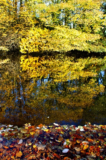
Even though I am ancient I still enjoy kicking my way through the fallen leaves as I’m walking down country lanes. The leaves offer an opportunity for some creative work with the camera – not that it’s my normal style, but I liked the colours and patterns of this shot across Langcliffe Mill Pond taken last Sunday.

Unfortunately, another engagement means I miss the Remembrance service at the village memorial today when the names of Langcliffe’s fallen are read out.

poppybw

Dales inspiration – whatever the weather

lanebw

I spent a great deal of my working life looking at photographs, deciding which should appear in the publications I worked on. Often the decision was down to the story told by the photo rather than its artistic or technical merits. When all those points were satisfied in one shot the chances were I wouldn’t be able to afford to pay for it. Now I’m retired but I still enjoy looking at photos. The internet provides a wealth of photographic material for me to view (get your minds out of the gutter, please!) but I also love visiting photo exhibitions where the art of printing and presenting also comes into play. On a very wet Wednesday I went to Wensleydale to see a photo exhibition by Selside photographer Hilary Fenten at the Dales Countryside Museum in Hawes. She captures the essence of the Dales extremely well and obviously has a natural talent. Seeing such work helps inspire me with my own photography. The top picture showing Horton Scar Lane tells the story of Thursday – see later on in the blog.
hawesfall

The rain was pouring down in Hawes, as can be seen in this shot of the beck through the town centre.

weirfast

And back home  in Ribblesdale, this shot was taken with a shutter speed of 0.3000s which tells you how quickly the Ribble was traveling over Langcliffe Weir.

pond

While the river was raging like a good un just a few yards away, Langcliffe Mill pond looked serene. Stainforth Scar in the distance had a cloud for a hat almost all day…
mistyscar

Many folk had a fine sunset on Wednesday but a combination of low cloud and fog here created a strange light and the chance to take a direct photo of the sun.
cowsun

The previous day had seen clear blue skies as I strolled into Settle from Langcliffe via the high path. Grazing on the steep hills is donkey work, but the animal is perfectly developed for such land with its long back legs and neck.
donkey

I always think Castleberg rock provides a dramatic welcome to the town centre…
rocksettle

The forecasters predicted the rain would cease on Thursday afternoon so I planned a stroll up Horton Scar Lane from Horton village to see the water pouring into Hull Pot. The main waterfall was a great sight and there were smaller falls seeping out through the sides, making it look like a leaking dam about to burst. However, there wasn’t much of a collection of water in the bottom of this great hole so there must have been plenty of room underground to take it away down the hillside to eventually join the Ribble. I’ve witnessed water up to about halfway up the hole while other people tell me they’ve seen it full. It’s an awesome place and deadly if you are unaware of its presence on a misty day. At 300ft long, 60ft wide and 60ft deep, Hull Pot is thought to be the largest (natural) hole in England – although personally I think that title belongs to London.
hullpot2

I watched the cloud clear to reveal Penyghent but I wasn’t tempted to head up to the top – my excuse being it may well have started to get dark on the way back (honest).
penyzoom

The small wood near Ribblebanks at Langcliffe always puts on its coat of many colours around this time of year and is best seen from the opposite hillside above the railway line. The view over the stoneworks isn’t so pleasant but then this part of Ribblesdale, with all its natural resources, has always been home to industry with quarries, limeworks and mills providing employment for centuries.

ribblebanks

stoneworks

Hallowe’en passed by quietly apart from when I was preparing for bed. I looked in the bathroom mirror and saw a grotesque grey-haired old man looking back at me. Where did my youthful looks go?

Tributes, towers and tales from the Pennines

cotter

Bill Mitchell’s funeral service at Skipton Parish Church on Monday proved to be a fitting send-off for a Dales icon. His children David and Janet spoke eloquently as they recalled life with their famous dad. He would have been very proud of them. After the service I thought I’d pay a private little tribute to Bill by visiting one of his favourite spots. I once asked him to tell me of his best-loved places in the Dales – a terrible question to ask, and one to which I usually give a very wishy-washy answer.thornsbridge He preferred peaceful out-of-the-way locations where he could contemplate life rather than those featuring great long hikes over mountains. He liked Cotter Force (pictured above) and other waterfalls, and also Thorns Gill, near Ribblehead, where I took a little wander on Monday afternoon. The beck was low and the trees were changing colour and losing leaves, which meant I could see more of the quaint old bridge.

When I joined Dalesman Publishing Company in 1993 Bill had retired from being editor of Dalesman and Cumbria magazines some five years earlier but he still contributed to them and for a while continued to edit from home another magazine which the company owned called Pennine Magazine, later to become Peak & Pennine. Alongside Bill I subedited and laid out the pages, the old fashioned way to begin with – cutting and pasting bits of paper for an outside typesetter to prepare for press.  Bill was very fond of the magazine. It gave him chance to write about areas and subjects not necessarily associated with the more rural dales region. His interesting and popular Milltown Memories articles stemmed from this. On Tuesday I had the chance of a whistle-stop tour of some of the areas featured in the magazine which sadly is no longer published.
dovestone

The gritstone towns and villages clinging to the steep hillsides here are full of character. They sit in dramatic country where for centuries Man has tried, usually unsuccessfully, to tame  inhospitable land and conditions. The higher boggy moors of the South Pennines are really fit for nothing bar rearing game birds and a few hardy sheep. But it is the perfect place for collecting water, as witnessed by countless reservoirs which supply major industrial towns and cities of the north. They break up desolate landscape and provide some fine photography.
At Dovestone (pictured above), close to where the four counties of Yorks, Lancs, Derbyshire and Cheshire shake hands, the autumn colours brightened up for me what can sometimes feel to be a dark, claustrophobic – but exciting – landscape.
holmeframe

The sky and weather changes rapidly here on the high hills and this has proved inspirational for many leading artists, writers and poets. Holmfirth-based artist Ashley Jackson loves these moors and he has helped people visualise their beauty with the installation of metal frames around the district – see www.framingthelandscape.co.uk.  I called to see one at Wessenden, a bleak spot on the edge of Saddleworth Moor, and after a brief stroll around the picturesque Digley Reservoir, it was up the winding route to Holme Moss, 1719ft  above sea level. Here another of Ashley’s frames (pictured above) highlights a wide-reaching and varied panorama of moorland, industry and history.
castlehill

As if the hills aren’t already high enough in these parts, Man has decided to extend his reach even further. Holme Moss transmitter station stretches another 750ft high above the frame, while in the distance the giant TV mast of Emley Moor stands a whopping 1084 ft high with its tip almost touching 2,000ft above sea level. Tall wind turbines grab the considerable breezes to the south-east, while in the centre of the scene the grand Victoria Tower of Castle Hill is clearly visible. While I’m in full-flowing anorak mode, I can tell you that the tower is 106ft  high, which means that by standing at the top you are 1,000 feet, plus however tall you are, above sea level.
I drove down to the monument (pictured above) before dusk and although it wasn’t the clearest of evenings the 360 degree views were still a joy to behold. I then watched Huddersfield Town win 2-0 … also a joy to behold (but not as frequently available).
highway

Being very busy for the rest of the week I’ve had little chance to do much more photography or walking, but strolling into Settle along the Highway on Friday I was rewarded with a view of some fine autumn colours.
highway2

Pleasing news this week is that the government have at last (it’s taken more than two years) decided on enlarging the Lakes and Dales national parks to bridge the gap between the two. Important places like Orton Fell, Mallerstang (pictured below) and the northern end of the Howgills will from next summer fall under the Dales authority. The government now has to find a way to pay for this extension at a time when they are slashing all park and local authority budgets. Will they eventually decide to sell off the Dales National Park to the highest bidder? Will my forecast in an earlier blog of there being a McDonalds or a Starbucks at the top of Penyghent one day become reality? Let’s hope they remember that the national parks were created to protect our countryside for future generations, not to solve financial cock-ups, or make someone a fat profit, or place in private hands.

IMG_7716.JPG